DJI Neo
$2,180.00
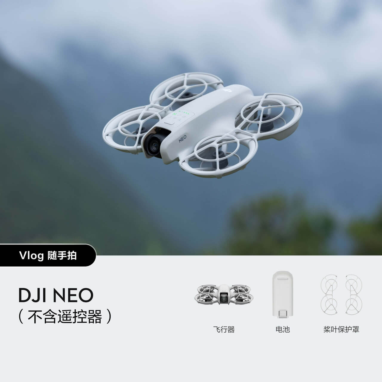
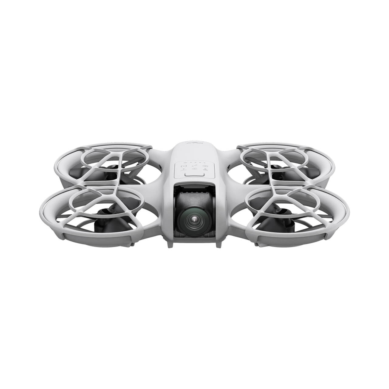
● 135g lightweight and portable
Zero threshold to take off and land on your palm
AI intelligent tracking, one-click filming
Multiple controls, rich gameplay
4K Super Stabilized Video
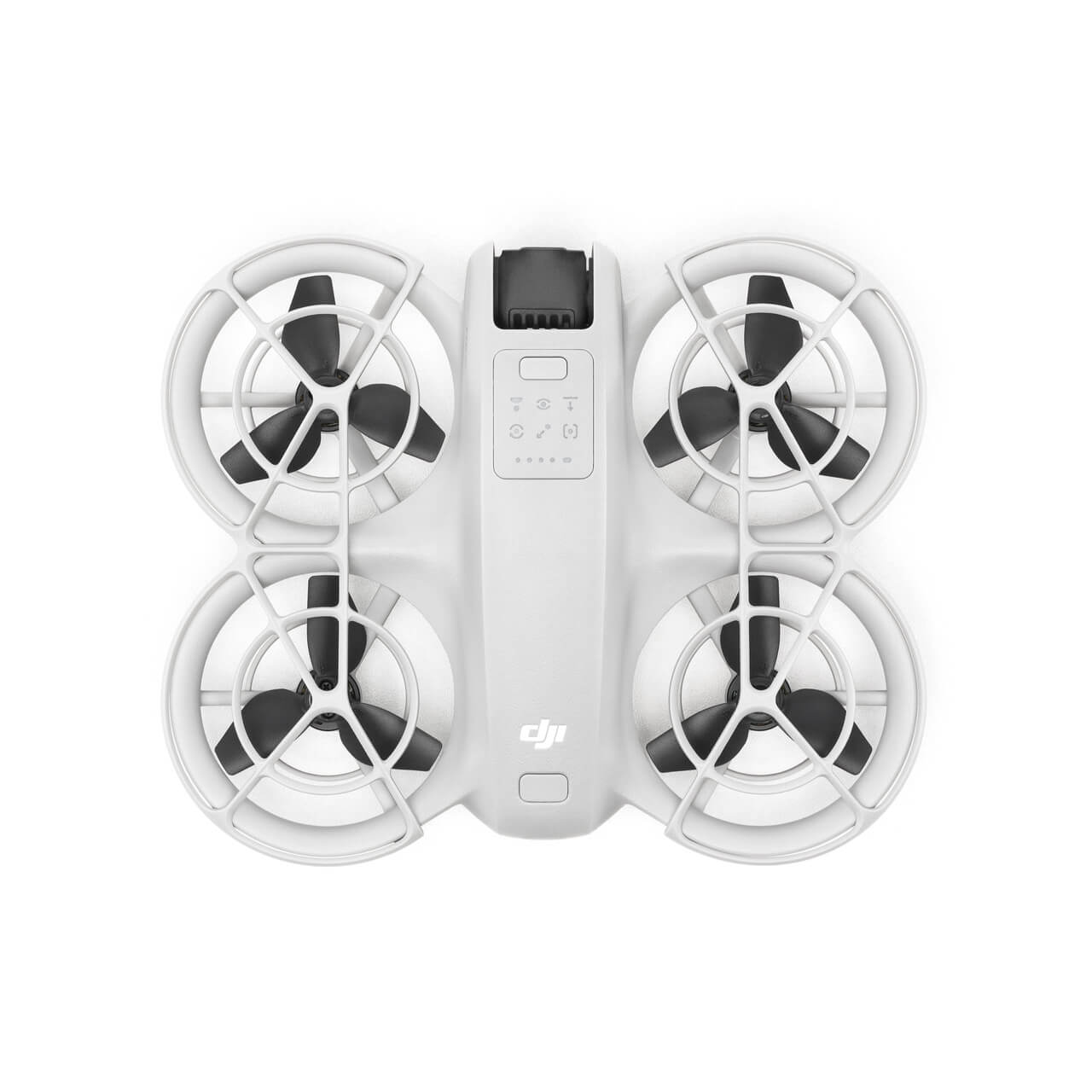
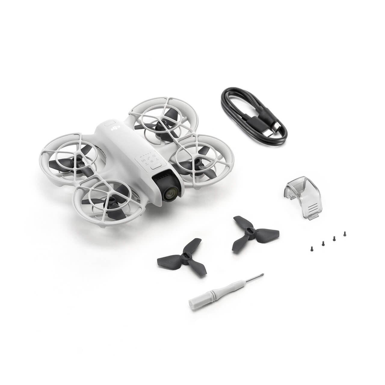
Fully enclosed protective cover is safer
描述
Technical parameters
Aircraft
Takeoff weight
About 135 grams
Dimensions
Length 130 mm, width 157 mm, height 48.5 mm
Maximum ascent speed
0.5 m/s (steady gear)
2 m/s (normal gear)
3 m/s (sports gear)
Maximum descent speed
0.5 m/s (steady gear)
2 m/s (normal gear)
2 m/s (sports gear)
Maximum horizontal flight speed (no wind near sea level)
6 m/s (normal gear)
8 m/s (sports gear)
16 m/s (manual gear)
Maximum takeoff altitude
2000 meters
In a windless environment, take off at an altitude of 2000 meters, rise vertically for 120 meters, and fly in sports gear until the remaining power is 20%. This is for reference only. Please pay attention to the prompts on the image transmission interface during actual flight.
Maximum flight time
About 18 minutes (about 17 minutes with propeller guard)*
Each battery can continuously complete at least 20 handheld takeoff and landing shots**
* In a windless environment, the camera parameters are adjusted to 1080p/30fps, the video mode is turned off, and the drone flies forward at a constant speed of 2 meters/second at an altitude of 20 meters until the remaining power is zero. The results may vary to varying degrees under different external environments, usage methods, and firmware versions. Please refer to the actual experience.
** After DJI Neo is activated, the battery is fully charged, and the drone is measured in the default settings, with the surround, skyward, and far-away shooting modes selected. This is for reference only.
Maximum hovering time
About 18 minutes (17 minutes with propeller guard)
In a windless environment, the camera parameters are adjusted to 1080p/30fps, the video mode is turned off, and the drone hovers at an altitude of 20 meters until the remaining power is zero. The results may vary to varying degrees under different external environments, usage methods, and firmware versions. Please refer to the actual experience.
Maximum range
7 km
In a windless environment, the camera parameters are adjusted to 1080p/30fps, the video mode is turned off, and the camera flies forward at a constant speed of 8 meters/second at an altitude of 20 meters until the remaining power is zero. The results may vary to varying degrees under different external environments, usage methods, and firmware versions. Please refer to the actual experience.
Maximum wind speed
8 m/s (force 4 wind)
Working temperature
-10℃ to 40℃
Satellite navigation system
GPS + Galileo + BeiDou
Hovering accuracy
Vertical:
±0.1 m (when visual positioning works normally)
±0.5 m (when satellite positioning works normally)
Horizontal:
±0.3 m (when visual positioning works normally)
±1.5 m (when satellite positioning works normally)
Onboard memory
22GB
Classification
EU C0
Camera
Image sensor
1/2 inch image sensor
Lens
Field of view (FOV): 117.6°
Equivalent focal length: 14 mm
Aperture: f/2.8
Focus point: 0.6 m to infinity
ISO range
100 to 6400 (auto)
100 to 6400 (manual)
Shutter speed
Video recording: 1/8000 to 1/30 sec
Photography: 1/8000 to 1/10 second
Maximum photo size
12 megapixel photo
4000 × 3000 (4:3)
4000 × 2256 (16:9)
Photo shooting mode
Single shot/timed shot
Image format
JPEG
Video resolution
Electronic stabilization off
4K (4:3): 3840 × 2880@30fps
1080p (4:3): 1440 × 1080@60/50/30fps
Electronic stabilization on
4K (16:9): 3840 × 2160@30fps
1080p (16:9): 1920 × 1080@60/50/30fps
Vertical shooting
1080p (9:16): 1080 × 1920@60/50/30fps
Video format
MP4
Maximum video bitrate
75Mbps
Supported file system
exFAT
Color mode
Normal mode
Electronic stabilization
Supports RockSteady, Horizon Balancing, and stabilization off*.
* When using 16:9 format, only RockSteady or Horizon Balancing are supported. When using 4:3 format, stabilization is not available. When stabilization is off, recorded video material supports Gyroflow offline stabilization.
Gimbal
Stabilization system
Single-axis mechanical gimbal (pitch axis)
Structural design range
Pitch: -120° to 120°
Controllable rotation range
Pitch: -90° to 60°
Maximum control speed (pitch)
100°/s
Angular jitter
±0.01°
Tilt correction
Supports video correction
Real-time image correction is not supported only when paired with flight goggles
Perception
Perception system type
Look down
Look down
Accurate hovering height range: 0.5 to 10 meters
Effective use environment
Below:
The surface is a diffuse reflective material with rich surface texture and a reflectivity greater than 20% (such as walls, trees, people, etc.)
Sufficient lighting conditions (greater than 15lux, normal indoor fluorescent lighting environment)
Image transmission
Image transmission solution
O4
Real-time image transmission quality
DJI RC-N3 remote control control: up to 1080p/60fps
DJI Flight Goggles 3 with cross-stick 3/FPV Remote Controller 3: Up to 1080p/60fps
Operating frequency band
2.4000 GHz to 2.4835 GHz
5.170 GHz to 5.250 GHz
5.725 GHz to 5.850 GHz
The operating frequency bands supported by each country/region and their corresponding available ranges vary. Please refer to local laws and regulations for details.
Transmit power (EIRP)
2.4 GHz:
<26 dBm (FCC)
<20 dBm (CE/SRRC/MIC)
5.1 GHz:
<23 dBm (CE)
5.8 GHz:
<26 dBm (FCC)
<14 dBm (CE)
<26 dBm (SRRC)
Communication bandwidth
Maximum 40 MHz
Maximum signal effective distance (no interference, no obstruction)
FCC: 10 km
CE: 6 km
SRRC: 6 km
MIC: 6 km
The above data is measured in an open outdoor environment without interference and obstruction. It is the longest communication distance of the image transmission function under each standard. The longest communication distance in actual flight scenarios is limited by the maximum range of the aircraft. Please pay attention to the return prompt on the image transmission interface during actual flight.
Maximum signal effective distance (with interference, without obstruction)
Strong interference (urban center): about 1.5 to 3 kilometers
Medium interference (suburban county): about 3 to 6 kilometers
Micro interference (remote suburbs/seaside): about 6 to 10 kilometers
The above data is measured in an unobstructed environment under various typical interference intensity scenarios under FCC standards. The actual flight distance is not guaranteed and is only used as a distance reference for users to fly on their own.
Maximum signal effective distance (with interference, obstruction)
Micro interference, with building obstruction: about 0 to 0.5 kilometers
Micro interference, with bush obstruction: about 0.5 to 3 kilometers
The above data is measured in various typical micro interference intensity and obstructed environments under FCC standards. The actual flight distance is not guaranteed and is only used as a distance reference for users to fly on their own.
Maximum download rate
Wi-Fi: 25 MB/s
Measured in a low-interference laboratory environment in countries or regions that support 2.4 GHz and 5.8 GHz dual-bands. Please refer to the actual download speed.
Minimum latency
With DJI RC-N3 remote controller: about 120 milliseconds
Depends on the actual shooting environment and mobile device.
Maximum image transmission rate
50Mbps
Antenna
Two antennas (one transmit and two receive)
Wi-Fi
Protocol
802.11a/b/g/n/ac
Operating frequency band
2.4000 GHz to 2.4835 GHz
5.725 GHz to 5.850 GHz
The operating frequency bands supported by each country/region and their corresponding available ranges vary. Please refer to local laws and regulations for details.
Transmit power (EIRP)
2.4 GHz:
<20 dBm (FCC/CE/SRRC/MIC)
5.8 GHz:
<20 dBm (FCC/SRRC)
<14 dBm (CE)
Effective operating range
50 meters
Measured in an open, interference-free environment. The actual transmission distance may vary depending on the usage environment. Please refer to the actual experience.
Bluetooth
Protocol
Bluetooth 5.1
Operating frequency band
2.4000 GHz to 2.4835 GHz
The operating frequency bands supported by each country/region and their corresponding available ranges vary. Please refer to local laws and regulations for details.
Transmitting power (EIRP)
<10 dBm
Battery
Capacity
1435 mAh
Weight
Approximately 45 g
Nominal voltage
7.3 V
Charging limit voltage
8.6 V
Battery type
Li-ion
Energy
10.5 Wh
Charging environment temperature
5°C to 40°C
Charging time
Through the charging hub (maximum charging power 60 W): charging three batteries in parallel, from zero to full charge takes about 60 minutes
Through the body charging (maximum charging power 15 W): from zero to full charge takes about 50 minutes
Charger
Recommended charger
DJI 65W portable charger
USB charger that supports USB PD fast charging protocol
Charging hub
Input
5 V, 3 A
9 V, 3 A
12 V, 3 A
15 V, 3 A
20 V, 3 A
Output (charging)
5 V, 2 An
Charging method
3 batteries can be charged in parallel
The number of batteries that can be charged in parallel depends on the power of the charging head. Using a charging head greater than 45 watts can charge three batteries in parallel, while using a charging head below 45 watts can only charge two batteries in parallel. Please refer to the charging protocol supported by the charging head.
Compatible batteries
Support DJI Neo Intelligent Flight Battery
Storage
Recommended memory card list
External SD card expansion is not supported
DJI RC-N3 remote controller
Maximum flight time
When not charging the mobile device: 3.5 hours
When charging the mobile device: 1.5 hours
Operating temperature
-10℃ to 40℃
Charging temperature
5℃ to 40℃
Charging time
2 hours
Charging method
5V, 2A
Battery capacity
2600mAh
Weight
Approximately 320g
Dimensions
Length 104.2mm, width 150mm, height 45.2mm
Operating frequency band
2.4000 GHz to 2.4835 GHz
5.170 GHz to 5.250 GHz
5.725 GHz to 5.850 GHz
The operating frequency bands supported by each country/region and their corresponding available ranges vary. Please refer to local laws and regulations for details.
Transmit power (EIRP)
2.4 GHz:
<33 dBm (FCC)
<20 dBm (CE/SRRC/MIC)
5.1 GHz:
<23 dBm (CE)
5.8 GHz:
<33 dBm (FCC)
<14 dBm (CE)
<30 dBm (SRRC)

admin –
Aliquam fringilla euismod risus ac bibendum. Sed sit amet sem varius ante feugiat lacinia. Nunc ipsum nulla, vulputate ut venenatis vitae, malesuada ut mi. Quisque iaculis, dui congue placerat pretium, augue erat accumsan lacus